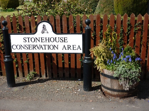
Environment - Introduction
Introduction
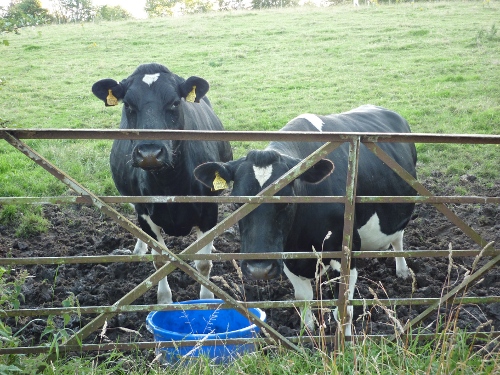
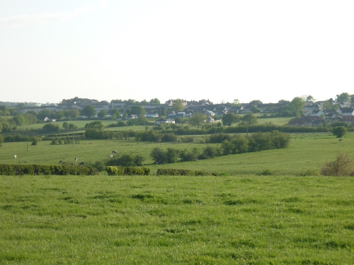
The Great Outdoors
Introduction
The Avon is one of the most endearing and beautiful of all the rivers
in Scotland, an inspiration to many a painter’s palette and poet’s
imagination. The river Avon flows through the parish from its source in
Ayrshire through the parishes of Strathaven, Glassford, Stonehouse,
Dalserf and thence into the Clyde a mile East of Hamilton.
The Avon is reckoned to be one of the best trouting streams in
Scotland. Salmon used to be plentiful until around 1816 when the mill-
dam at Millheugh was raised to procure a more consistent water supply
for the mills, thus the salmon were unable to leap the dam.
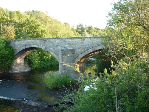
The Linthaugh bridge which spans the Avon was built in the late 18th
century to replace a bridge swept away in floods of 1771. The County
and local landowners paid for the new
bridge. This and many other bridges
were built by
Irish immigrants during an era of road building
and communication improvements.
From Hamilton to Stonehouse an almost uninterrupted range of rocks
overhangs the river Avon on both sides, the summits of which are
covered with natural wood of ash, birch, oak, elm and many more. The
bed of the river in places is congested with large areas of rock which
have fallen from the strata, often obstructing the natural flow of the
water’s passage.
Old shale mines can be
found on the banks of the Avon near the
Ritchies. These mines were said to have been worked by monks (possibly
from Lesmahagow) and later used to extract oil from shale at the oil
works nearby. These caves can still be accessed, but it is not
advisable as they are low roofed, dark and a labyrinth of tunnels lie
within. These mines were said to have been worked, to extract coal,
during the general strike of 1926. It is said there exists a tunnel
travelling under the Avon to the North bank, and that a large cave with
luminous stalactites hang down from above. This cave is said to be
accessed through one of the said shale mines.
The Avon has many tributaries which in themselves have a natural beauty
and interest. The largest of these is the Kype Water which flows
through the hamlet of Sandford. In its
course to the Avon it forms a
cascade of some 50ft at St.Helen’s old mill, better known as the
Spectacle E’e falls. The origins of the name are uncertain but the
following extract from ‘The Larkhall & Stonehouse Gazette’ is the
popular and romantic version of how the mill came by its name. This
theory, however, is questionable, as photographic evidence from a later
date, clearly shows the mill in good working order.
It is said that long,
long ago the miller of Spectacle E’e was prosperous and content. But he
was also stubborn and haughty. And as he became a miller in so romantic
a spot, he had a lovely daughter who was the apple of his eye. She also
delighted the eye of a youth in the hamlet up the stream, but the
miller would have none of him. And the youth plotted revenge. One day,
towards noon, the people working the fields saw smoke and flames leap
up through the trees at the waterside. The mill was on fire! When the
flames died down, only the wall remained, but it is not known whether
the miller perished or that the youth and the maid were afterwards wed.
But the tale was told that, in the night, the spurned suitor had
climbed the thatched roof of the mill and fixed by their legs, a pair
of spectacles so that, when the sun beat fiercest on the thatch, the
lens caught the rays and concentrated them to a burning pin-point on
the dry and warm straw. When the flame burst he was far from the mill
and so had an alibi. That’s how the mill got its name “Spectacle E’e”.
Equally enthralling is the Cander Water, a stream rising from the
Parish of Lesmahagow, some six miles to the ‘meetings’ of the waters
(Avon) at the ‘Fairies Rock’, where it is said fairies would come out
after dark and dance the night through. Access to the Cander is
extremely difficult from the Avon. It can however be accessed from Double Dykes by decending
down the Cander gorge, though it is not
advised for the faint hearted. The easiest route when reaching the
Cander water is direct through the water. This stretch of water is not
deep but there are many blockages of fallen debris which make passage
more difficult. The feeling of seclusion and silence in this gorge is
breathtaking, as is the wild garlic, abundant in late Spring.
Spanning the Cander you will find Woodlands bridge built in 1827 by
Thomas Telford around the time of the Edinburgh to Ayr turnpike road
becoming established. Situated up river on the Cander is the remains of
Cander grain mill. Formerly powered by water driven machinery, the mill
was converted to electricity in 1957. Still in evidence today is the
wheel which drove the drive shaft to the Candermains grain mill above.
A hydraulic ram is also situated here formerly used to pump drinking
water from a well to Candermains. The pumping action of the hydraulic
ram and the sound that it made became referred to as the ‘devils
hammer’. If the Cander water is followed towards its source you will
encounter the site of the former sandstone quarry at Overwood, thence
on to Gill bridge where a mill formerly stood. Unfortunately a fire
reduced the mill to ruins in 1879.
There are no lochs in the parish but there was at one time at
Goslington, a large area of marsh which supported many water fowl
including wild geese and ducks. The Avon in its natural setting is a
haven for many birds such as tawny owls, mallards, dippers, buzzards,
cormorants and the occasional kingfisher, one of which was spotted near
the Linthaugh bridge in recent years. Wildlife is abundant if you know
where to look. Deer, mink, badgers and even the otters have returned to
the seclusion of these waters. In its often tropical appearance the
Avon gorge also supports many rare plant species such as Herb Paris and
the Lesser Wintergreen. Robert Naismith, a keen botanist, was eager for
children to explore and learn from the many interesting and educational
elements found within their environment.
“To train the youth to
know the wild flowers of the district in which they reside would be an
interesting, instructive, and
beneficial method of
imparting additional zest into their holiday rambles, and would leave
sunny memories in their minds for
all future time”.
Robert Naismith 1885
Researching through old maps of the district, it appears that in 1768
the river Avon, at the Horsepool had a diversion cutting directly
across the land. This may have been a man made diversion, in connection
with the mill situated at the Horsepool.
The Great Outdoors
With our ever changing environment, through atmospheric deterioration
and the constant expansion into our so called ‘greenbelt’ protected
areas, we face a perpetual fight to preserve and maintain our natural
surroundings. Through the advancement of learning and awareness, we,
and future generations, must help safeguard and educate those in power,
to recognise the need to halt the erosion of our countryside, and the
decline of our more rare flora and wildlife alike.
As a community we are under the constant threat of opencast mining,
which is advancing towards our village at an alarming rate. Having
previously investigated and objected to an application near Watstone
farm in the past, I have grave concerns regarding not only the effects
upon the welfare of the community, but equally upon the environment.
We, in Stonehouse, are fortunate to have the best of both worlds on our
door step; the comforts of the city, and the freedom of the
countryside. The parish of Stonehouse possesses more rights of way than
any other ward, in the former Hamilton District. These right of ways
have not been created at random, but have transpired because people
have found a particular route more convenient for their journey to
work, church, school or other destination. The right of the public to
use such routes for reasonable purposes, has been acknowledged in the
past by landowners, where the routes exist.
In the old Stonehouse parish, as in other parishes throughout the
country, the network of routes reflect the economic and social history
of the area. For instance, over half the rights of way in the former
Hamilton District have access to some industrial usage, primarily to
coal pits (Dovesdale - Broomfield Pit), quarries (Watstone - Overwood
sandstone quarry), limekilns, oil works and mills (Sandford- Spectacle
E’e Mill). Some routes provided general access, such as drove roads,
and railway stations; while some routes follow the lines of ancient
roads (Tanhill - Roman Road) and village
lanes. In addition to these, a
few routes led to churches, schools and allotments. All rights of way
have their origin in the public need for a route from one place to
another, whether for employment, religious or recreational purposes.
These old rights of way were once travelled on foot, or horseback and
in later days, wheels. Many now lie beneath tarmac, but others remain
in their ancient state, as mere tracks through the heather, not always
visible without direction. Many of the country routes were drove roads,
by which cattle and sheep were driven to market, and indeed in some
instances still are today. “Kirk” and “Coffin” roads were also common;
the former being a route to church, and the latter to the graveyard.
In order to preserve these ancient routes, it is up to the residents,
and those walkers seeking the escapism of the city, to ensure the right
of ways are used regularly, to preserve what have been handed down, and
sometimes fought for by our forefathers. In doing so, the utmost
respect and care must be given to those who make a living from the
land. In my many adventures into our countryside, I have experienced an
awakening of adventure and relaxation, from the quiet, timeless
seclusion of the Cander gorge, to the excitement and expectation of
finding one of our many historical sites, hidden away in our parish.
Influenced greatly by local walkers, such as Hugh Burns and the late
T.E. Harkness Graham’s ‘Tributaries of the Avon’, I took a keen
interest in our countryside and the treasures within. Through local
knowledge, research and exploration I have endeavoured to record and
share my experiences with others through local walking guides, such as
a Right of Ways booklet and ‘A dauner roon the Cauner’. In doing so I
have compiled and recorded the flora, birds and creatures I have
witnessed on my rambles.
The late Ralph McLeod similarly undertook a more detailed survey in
1966, which recorded the names, whereabouts, significance and Latin
term of the birds and plant life he encountered. This excellent project
indicates the demise of some species and development of others in
comparison to local studies of recent, some of which I expect are due
in part to agricultural changes and the expansion of housing into the
greenbelt. For instance, Ralph recorded sightings of skylarks, tree
creepers, red shanks, song thrushes and blackcaps which were common
locally in 1966, but which have now either disappeared locally, or, are
exceptionally rare. In particular, the sighting of Corncrakes in the
area of the Tilework park, are a prime example of how agricultural
developments have reduced such nationally, leaving Corncrakes confined
to a few isolated areas of the country. On the other hand, rarities in
1966 such as the magpie, lapwing and sparrowhawk are now common place
throughout the old parish.
|
|